Compass: Terra
Try Compass: Terra Individual Free for 30 Days
Get full Pro access, no credit card required. Transform your PDFs and AGS files into an interactive 3D model in seconds.
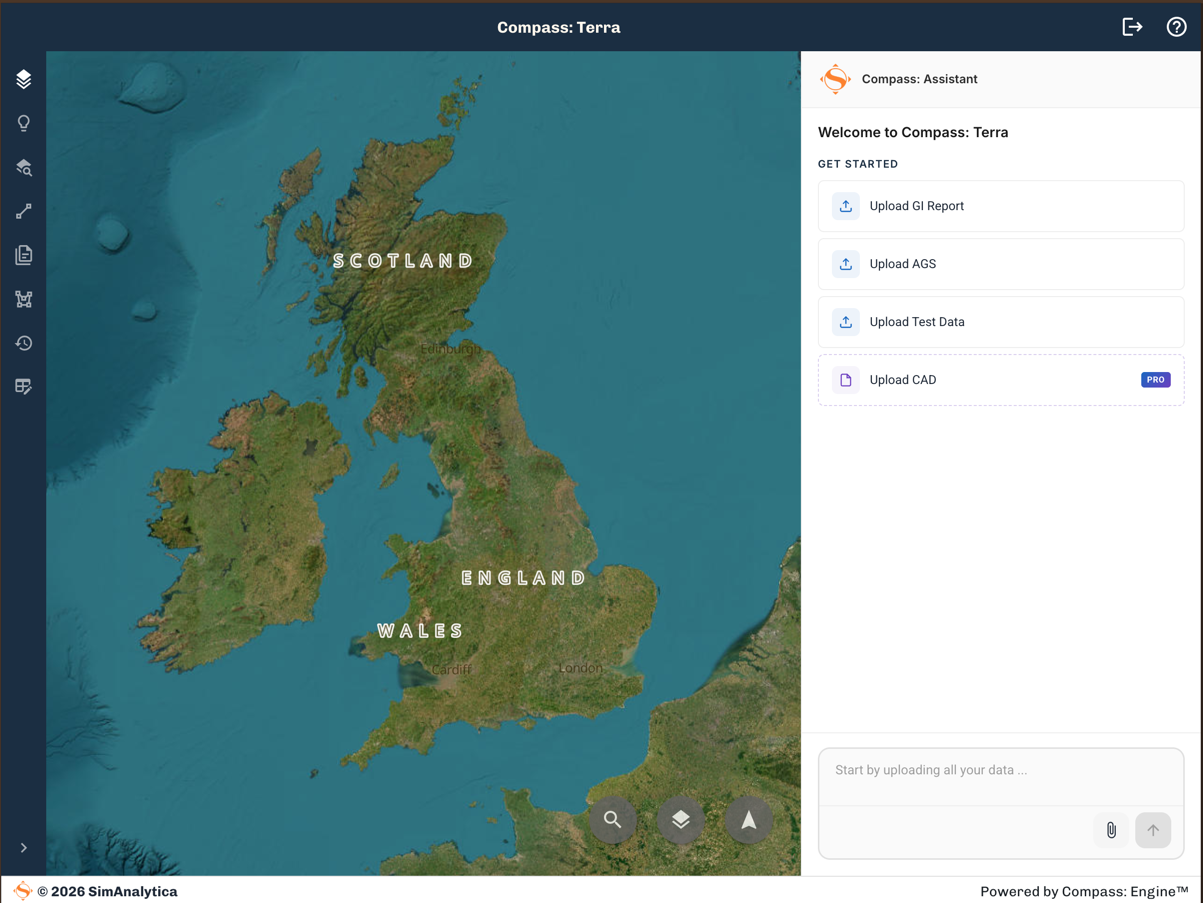
- View your data on a map
- Ask questions with a verified AI assistant
- Stratigraphic column, SPT and particle size visualisation
- Export to AGS, CSV and GIS
No credit card required · Full Pro access for 30 days
How It Works
How Compass: Terra Works
Four steps from raw data to actionable insight
Import
Import all your site data: PDF reports, AGS and Excel test data
Drag and drop borehole reports, AGS files and Excel test data. Every log is extracted, structured and georeferenced automatically in seconds.
Interrogate
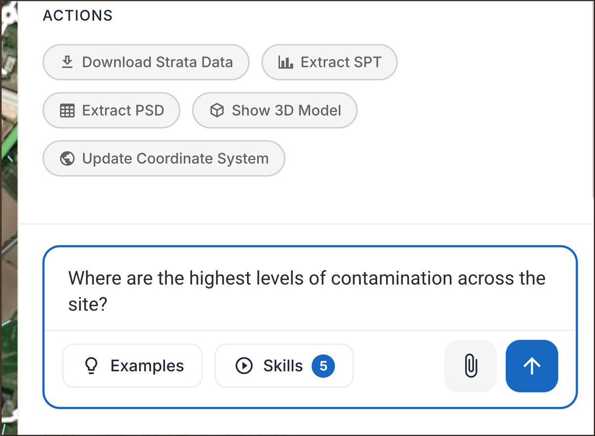
Interrogate your site with a verified AI assistant
Ask questions in plain language and get answers grounded in your own data, with sources you can check. No hallucinations.
Visualise
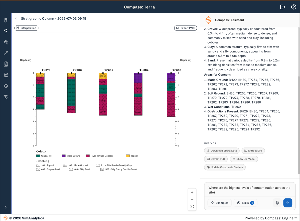
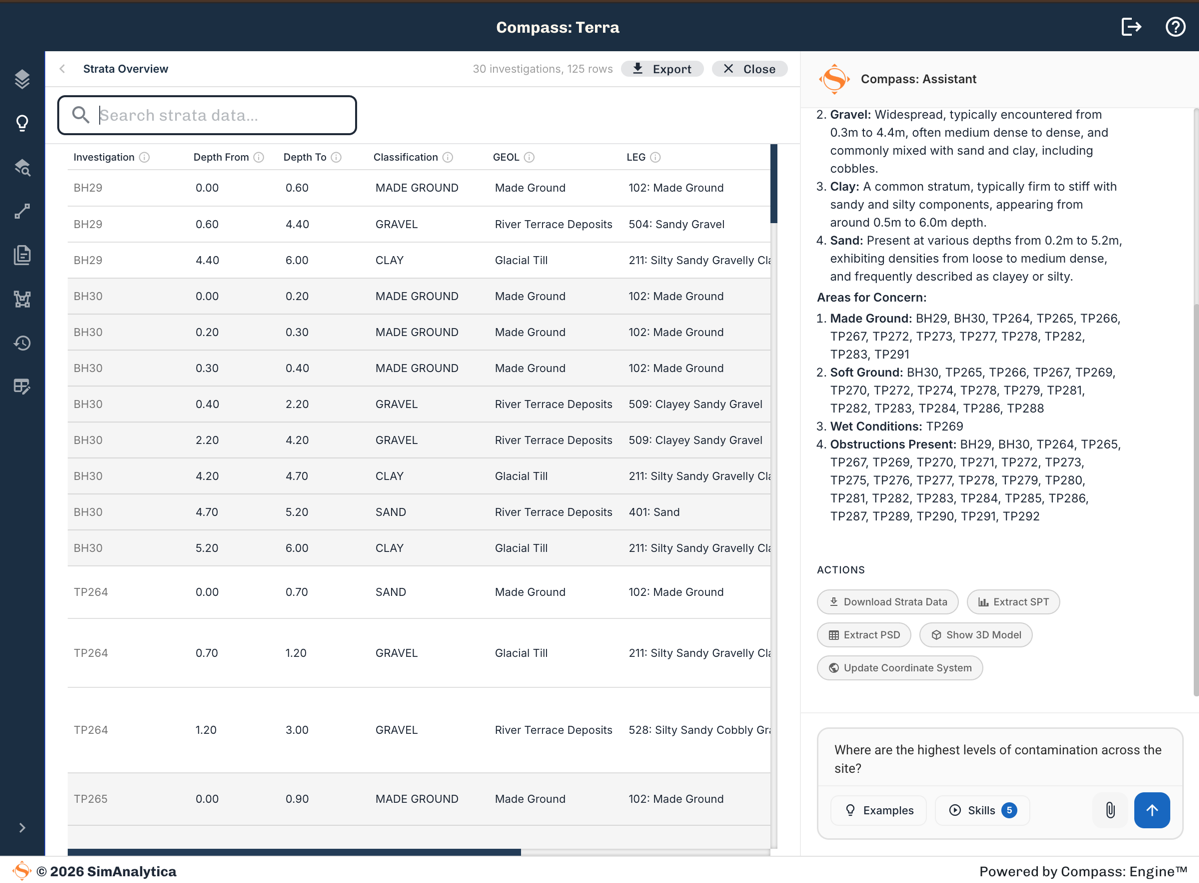
Visualise strata, SPT and particle size in interactive 3D
Explore strata layers, SPT results and particle size distributions in an interactive 3D model of your site.
Export
Export to AGS, GIS, CSV and Excel
Send structured, validated data straight into your workflow as AGS, GIS, CSV or Excel, ready for the next stage.
Start with a free 30-day Pro trial, then choose your plan:
Every plan includes
Data Import
- Multiple files per site
- AGS
- Excel
Visualisation
- Interactive 3D site model
- SPT and PSD analysis and visualisation
- Link to original evidence
Analytics
- AI Assistant site interrogation
- Stratigraphic column and strata volumes
- 3D Ground Model
Contextual Data Layers
- BGS GeoIndex
- BGS 1:50k Geology maps
- DEFRA flood risk
- Climate Risk Data
Export
- AI project summary
- Digitalised log and test data export
- AGS and GIS export formats
No credit card required, full access for 30 days
- Users:
- Single user account
- Sites:
- 12 included, additional sites £99 each
- Management:
- No project sharing or collaboration
- Users:
- Up to 5 user accounts
- Sites:
- 12 included, additional sites £99 each
- Management:
- Shared team workspace
- Users:
- Multiple organisational users, uncapped
- Sites:
- Bulk discount
- Data import:
- CAD data import/export
- Site data:
- Premium contextual site data sets
- Upload your own GIS layers
- Visualisation:
- Site plan and finish levels
- Export:
- Branded, scheduled and automated report generation
- Team roles and permissions
- DMS integration
Example: a 3-person team
3 Individual seats
£297/month (or £2,997/year)
- Siloed, unshared projects
- No collaboration between seats
Team plan
£199/month (or £1,999/year)
- Shared team workspace
- Collaborate on the same sites
Save £98/month (£998/year) and unlock collaboration with Team
Questions about the trial?
Speak to the team about Compass: Terra Individual or find out more about our Enterprise offering.
We use cookies to analyse site usage and improve your experience. By clicking Accept you consent to our use of analytics cookies. Read our Cookie Policy.