Before a single trial pit is dug on a new site, there's usually already a wealth of ground knowledge sitting in the British Geological Survey's public records: regional geology maps and often decades of borehole logs from investigations carried out nearby.
The trouble is getting that data into a usable state. Cross-referencing BGS's geology layers and GeoIndex records by hand is a slow, manual exercise that normally happens before a scoping report is even written. Compass: Terra pulls that data in automatically and merges it with your own site data, so every project starts from existing ground knowledge rather than a blank map.
01 Regional Geology, At Your Site
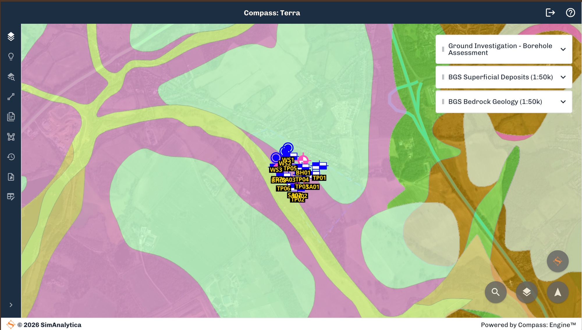
Set a site boundary in Terra and the BGS 1:50,000 scale geology maps for that location load in as a contextual layer alongside your own data, rather than as a separate PDF or a tab in another application.
It gives every project a regional geological baseline from the outset, covering superficial and bedrock deposits, faulting and formation boundaries. Use it to sanity-check what your own investigation data is telling you and flag where it doesn't line up.
02 Finding What's Already Been Drilled Nearby
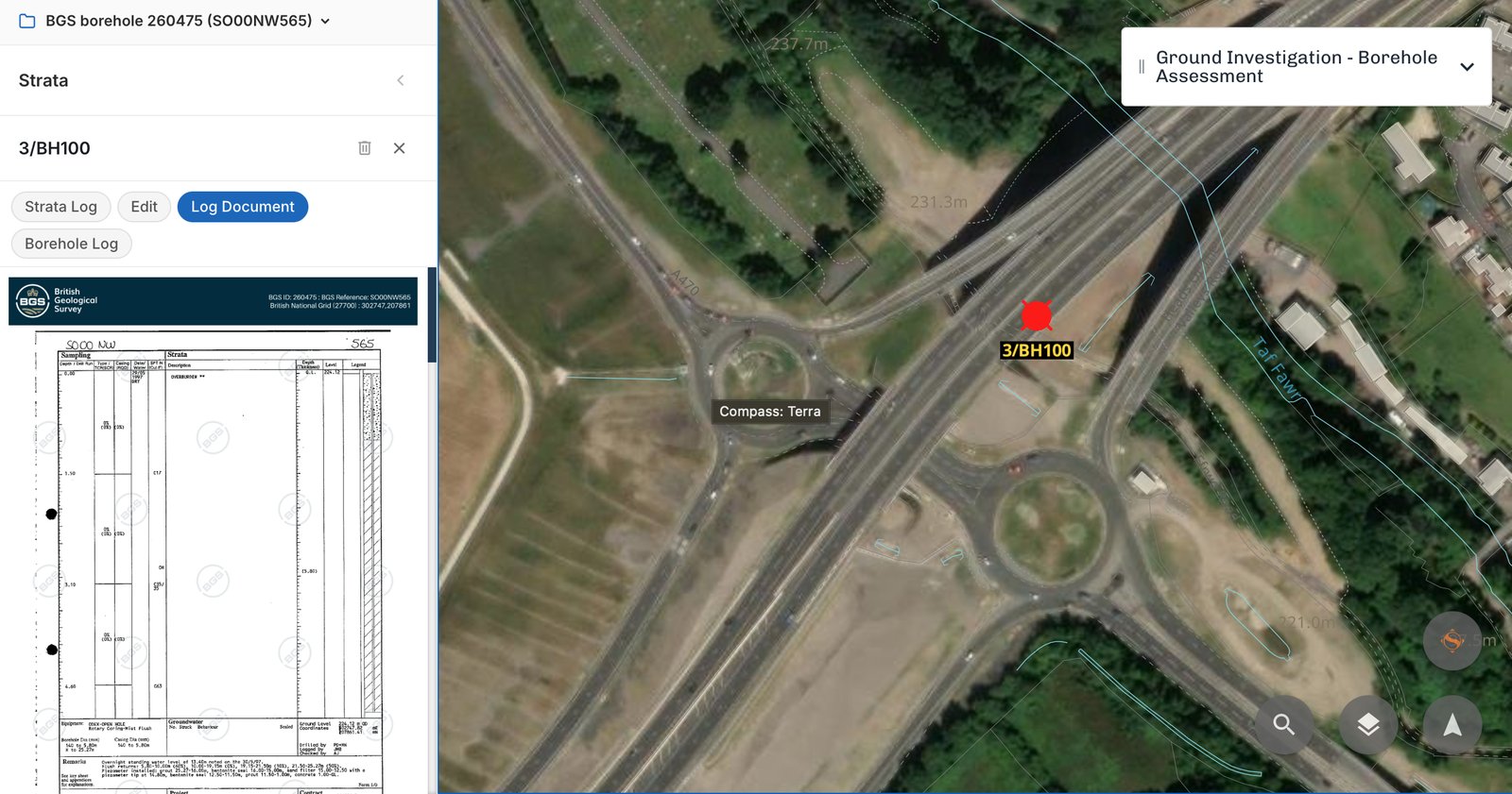
Terra searches BGS GeoIndex for your site and its surrounding area, surfacing historical boreholes and site investigation records that are already on file. It's work someone else has already paid for, sometimes decades worth of it in a single location.
Instead of searching GeoIndex manually and working out which of the results are actually relevant to your site, the results appear georeferenced against your own boundary, so you can see straight away what's nearby and worth pulling in.
03 Turning Historical Scans Into Usable Data
Finding a historical borehole log is one thing; a lot of what GeoIndex holds is scanned paper records, not structured data. Terra runs the same extraction it uses on your own uploaded borehole PDFs and AGS files against relevant GeoIndex logs, digitising strata, depths and test results into the same structured format as everything else in the model.
That means historical ground data doesn't just sit in the background as reference material. It becomes part of the queryable site model itself, on equal footing with data from your own investigation.

04 One Model: BGS Context Plus Your Own Data
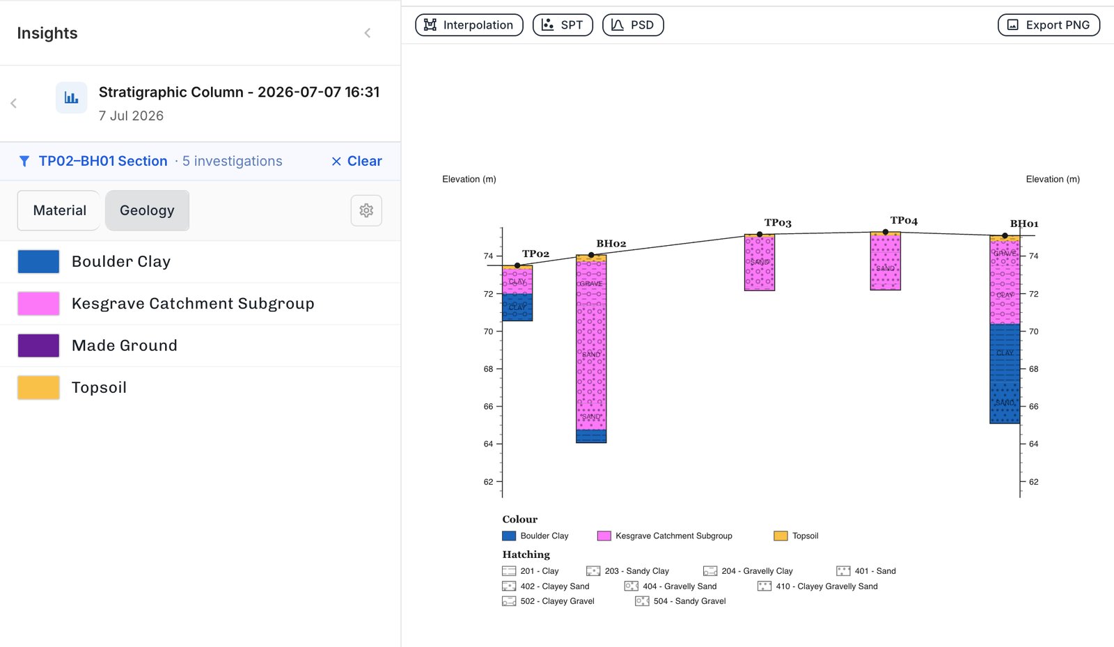
The point isn't the BGS data sitting next to your data. It's BGS data improving your data. Borehole logs usually describe strata in generic material terms: CLAY, SAND, GRAVEL. Terra cross-references those descriptions against BGS's regional geology and the BGS Lexicon of Named Rock Units to classify each stratum against its actual geological formation, so a layer logged simply as "clay" can be identified as Boulder Clay, or a layer of "sand" as part of the Kesgrave Catchment Subgroup.
Switch between Material and Geology views on any cross-section through your site model to see both: the raw material description your logs give you, and the real geology underneath it. You end up building on named formations rather than generic material names alone.
Compass: Terra is SimAnalytica's ground investigation platform, turning borehole reports and contextual data into a queryable digital site model.