
Use Case: Ground Investigation & Remediation

Using software to do Ground Investigation work

Discover how engineers are using Compass: Terra Ground Investigation software to improve their workflows in the real world.

Ground Investigation software is saving time and supporting more accurate analysis every day.

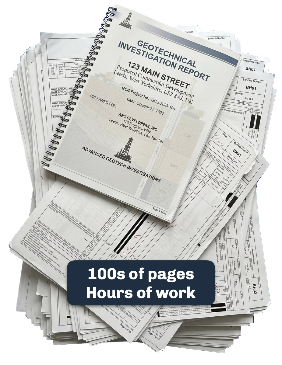
A stack of geotechnical investigation reports and borehole logs, labelled "100s of pages, hours of work"

01 · Data Extraction

Extracting Data From Hundred-Page PDF Reports

When considering sites for construction Engineers have to sift through 100s of pages of geotechnical investigation reports and borehole logs. As sites and projects move through teams this interpretation gets repeated multiple times leading to massive repeated effort.

Compass: Terra reads the PDF for you. Upload a report and its AI extraction identifies each borehole and trial pit, reads the strata descriptions, depths and test results, and turns it into structured, geolocated data in minutes rather than hours. AGS files and Excel test data import the same way, so everything from a project ends up in one place, ready for the real work to begin.

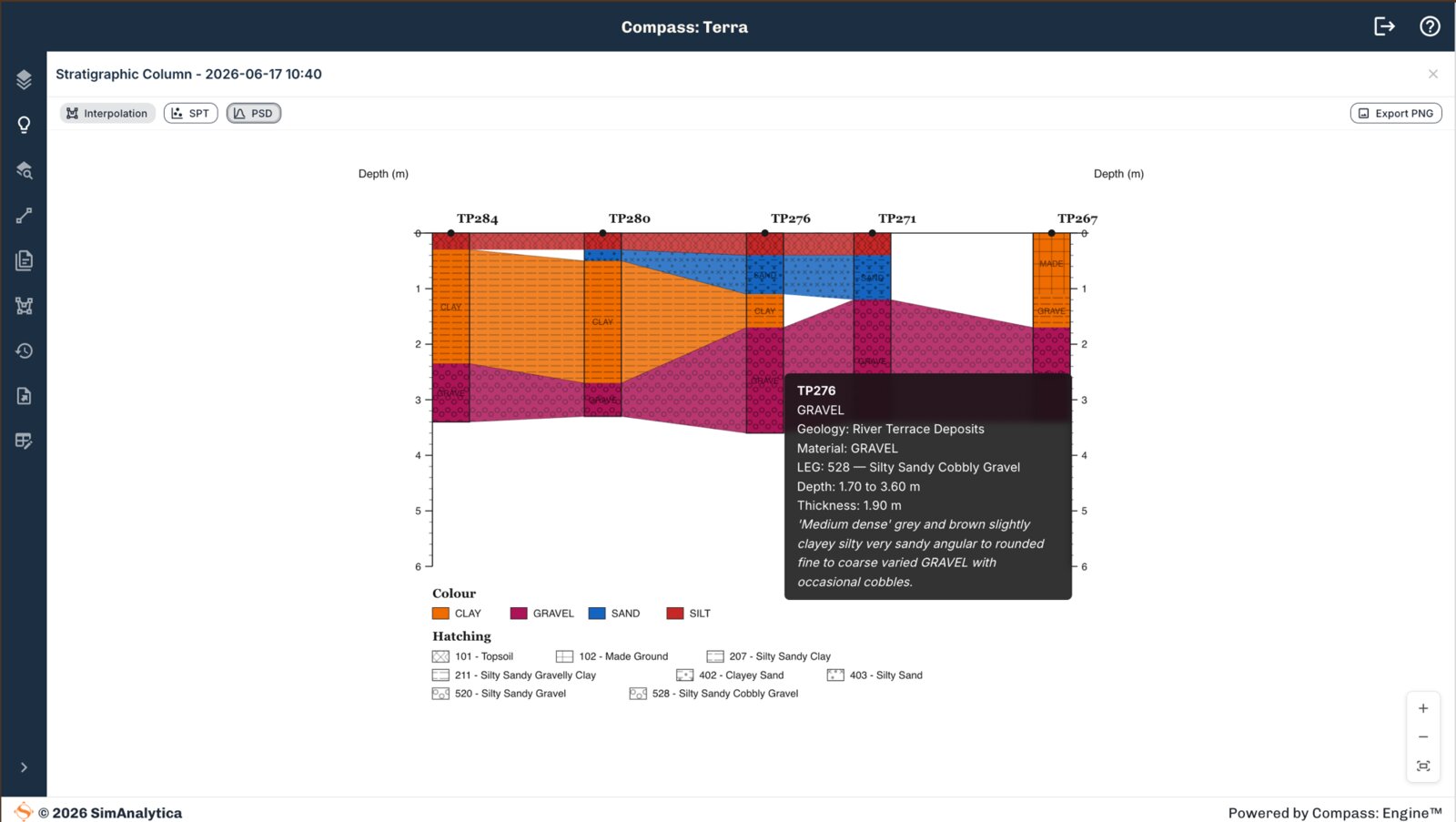
Compass: Terra stratigraphic cross-section across five trial pits with Interpolation, SPT and PSD tabs, showing a GRAVEL stratum tooltip with geology and material detail

02 · Interpreting Test Results

Using Compass: Terra to Interpret and Plot Test Certificates

Standard Penetration Test blow counts and particle size distribution curves are core to interpreting ground conditions, however the results are often supplied as separate lab sheets or in Excel spreadsheets. In Compass: Terra test results are processed automatically and sample results are linked back to the original investigation they were taken from.

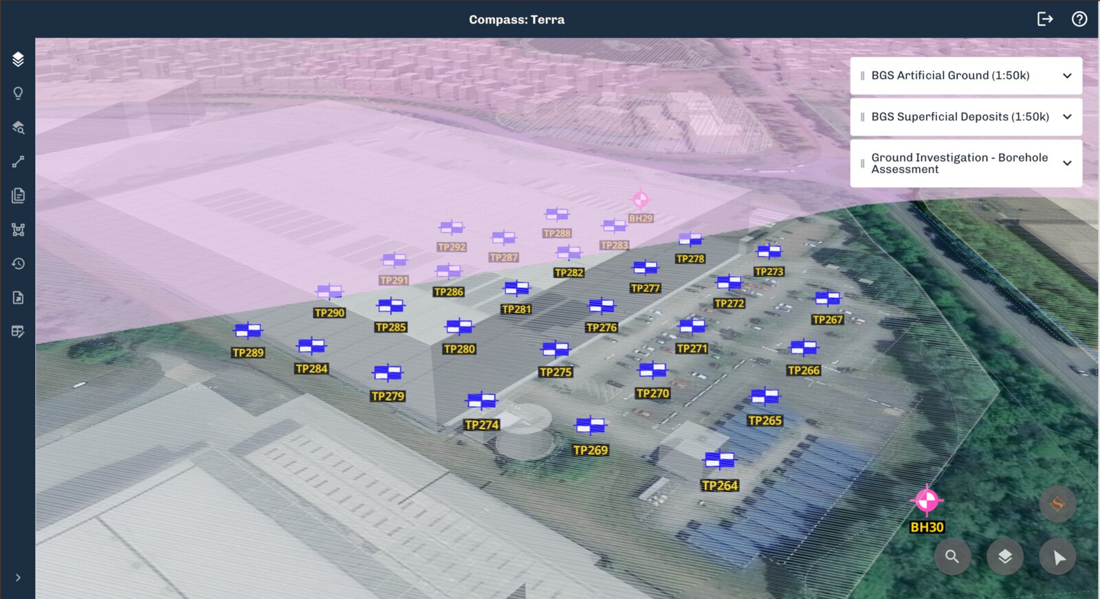
This gives you a unified view of test results, organised on a map, and ready to be plotted in your Cross Sections.

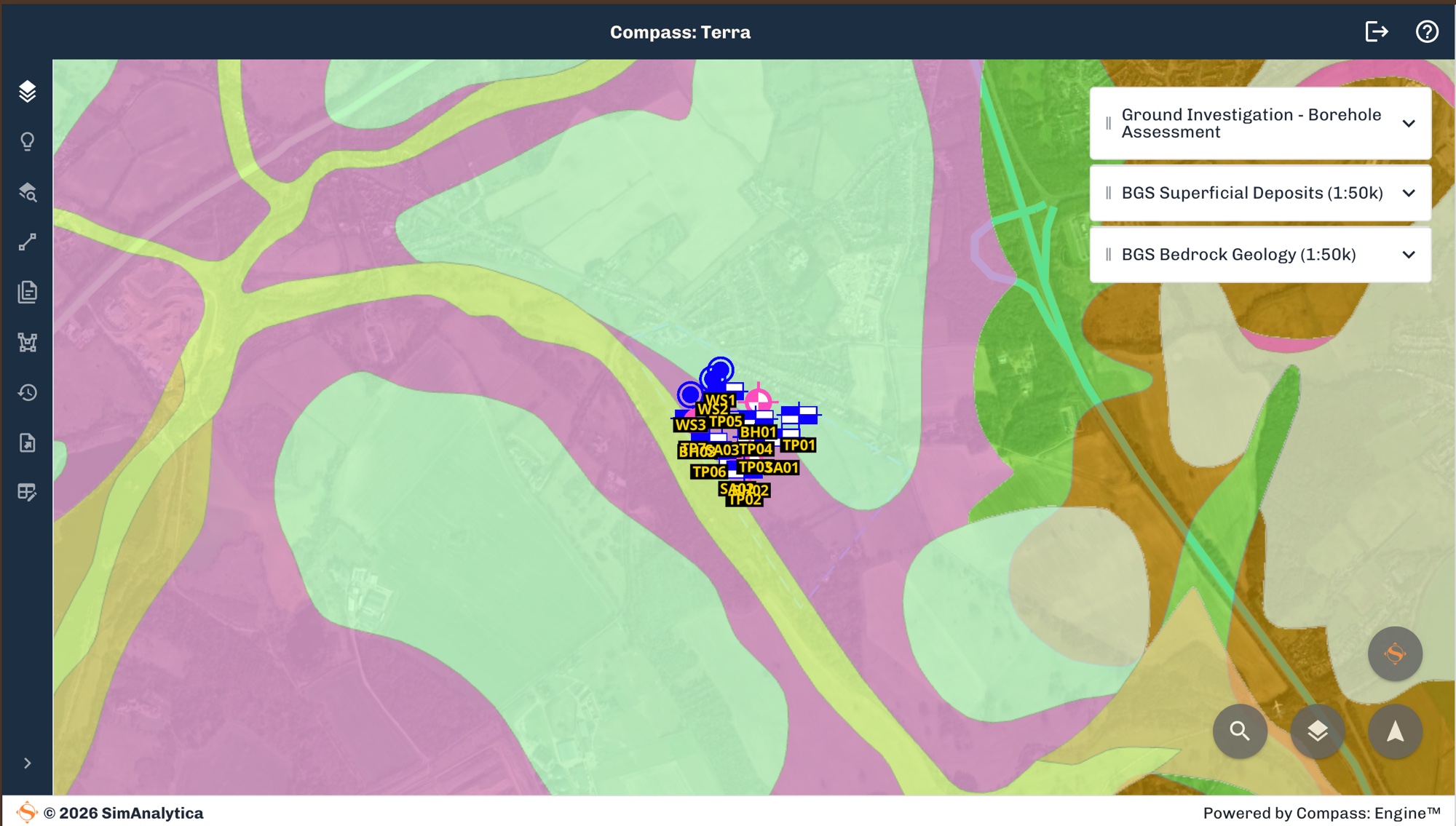
Compass: Terra map view with BGS Superficial Deposits (1:50k) and BGS Bedrock Geology (1:50k) layers switched on, showing trial pit and borehole locations plotted across the site

03 · Contextual Data

British Geological Survey, NaFRA and the Data that takes time to find

Before the first investigations take place engineers use public (and private) data to build knowledge about a site: British Geological Survey (BGS) regional geology maps, historical borehole records, national flood risk, historic landfill and sites of special scientific interest. Finding the right data and working out what is relevant to your site takes time.

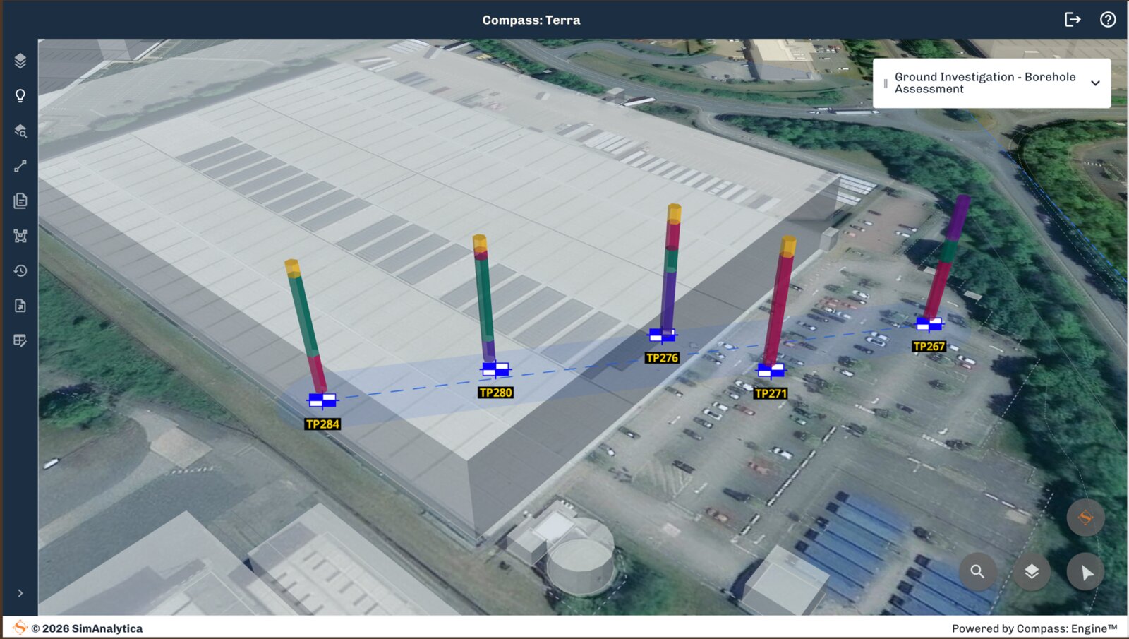
Terra pulls BGS 1:50k geology layers and GeoIndex historical boreholes in automatically, digitising scanned historical logs the same way it handles your own uploads. NaFRA flood risk data, published by the Environment Agency, loads in as a contextual layer alongside it, so regional context sits next to your site data from day one rather than as a separate PDF or map.

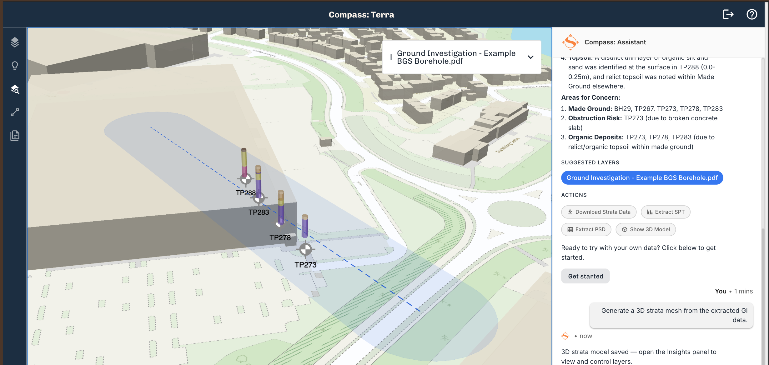
Compass: Terra 3D site model with borehole columns plotted directly on aerial site imagery, combining the spatial view and ground data in one workspace

04 · Working With Other Tools

One Workspace Instead of Esri, Google Earth and Excel

Ground Engineering workflows can easily end up spread across multiple tools, GIS applications to store the location of investigations, AGS tools to see the strata our old friend Excel to generate charts and process Lab Results. Some Ground Investigation software even asks you to fill in a custom spreadsheet before it can show you anything useful.

Terra puts the spatial view, the borehole data and the analysis in one workspace, work you’d otherwise do in Esri, Google Earth, Excel or CAD happens in one place and grows automatically as new information is received.

Compass: Terra becomes a true LIVE view of your data evolving as you work.

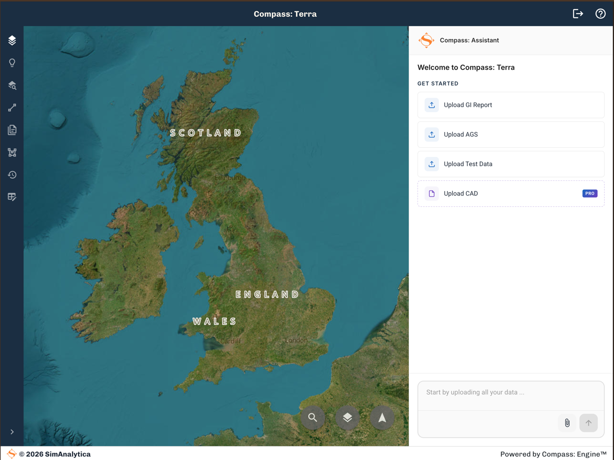
Compass: Terra upload screen with Upload GI Report, Upload AGS, Upload Test Data and Upload CAD options

05 · AGS Data

Working With AGS Files Without Wrestling AGS Software

AGS is the standard format for exchanging geotechnical and geoenvironmental data in the UK, but generating and checking it usually means specialist software.

Upload AGS directly into Terra alongside your PDF reports and Excel test data, and it becomes part of your model.

If you need to share the data with others Compass: Terra supports both built in project sharing and AGS export, so your data can never get stuck with one provider.

Further Reading

More on ground investigation with Compass: Terra

Ground Investigation Just Got an Upgrade
Product Launch

Ground Investigation Just Got an Upgrade

Compass: Terra Professional launches today, taking raw GI reports through digitise, visualise, analyse, and utilise so you spend less time processing and more time engineering.

4 min read

Get Started

See Compass: Terra on your own site

Upload your first ground investigation report and get structured data, a 3D site model, and AI-powered analysis in minutes.

We use cookies to analyse site usage and improve your experience. By clicking Accept you consent to our use of analytics cookies. Read our Cookie Policy.